From Wikipedia, the free encyclopedia
 Size of this preview: 640 × 429 pixels
 Full resolution (763 × 512 pixels, file size: 64 KB, MIME type: image/jpeg)
 |
This is a file from the Wikimedia Commons. The description on its description page there is shown below.Commons is a freely licensed media file repository. You can help.
|
| Description |
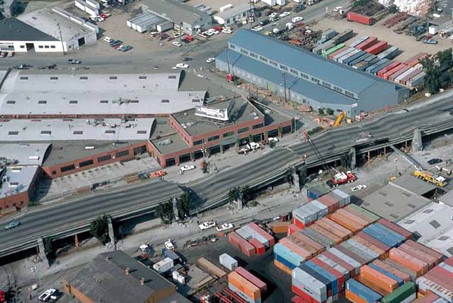
USGS photo from 1989 en:Loma Prieta earthquake. Caption: Aerial view of collapsed sections of the en:Cypress Viaduct of en:Interstate 880. [H.G. Wilshire, U.S. Geological Survey] Original image here: http://pubs.usgs.gov/dds/dds-29/web_pages/oakland.html A related image:

Cyprus Viaduct catastrophe. Note lack of anti-burst wrapping and lack of connection between upper and lower vertical elements.
|
| Source |
Originally from en.wikipedia; description page is/was here. |
| Date |
2003-08-12 (original upload date) |
| Author |
Original uploader was Minesweeper at en.wikipedia |
Permission
( Reusing this image) |
PD-USGOV-INTERIOR-USGS.
|
License information
 |
This image is in the public domain because it contains materials that originally came from the United States Geological Survey, an agency of the United States Department of Interior. For more information, see the official USGS copyright policy |
|
Original upload log
(All user names refer to en.wikipedia)
- 2003-08-12 11:59 Minesweeper 763×512×8 (65971 bytes) USGS photo from 1989 Loma Prieta earthquake.
File history
Click on a date/time to view the file as it appeared at that time.
|
|
Date/Time |
Dimensions |
User |
Comment |
| current |
05:27, 30 November 2006 |
763×512 (64 KB) |
Zzyzx11 |
|
File links
The following pages on Schools Wikipedia link to this image (list may be incomplete):


