Image:Map of Great Barrier Reef Demis.png

From Wikipedia, the free encyclopedia
Wikimedia Commons logo This is a file from the Wikimedia Commons. The description on its description page there is shown below.
Commons is a freely licensed media file repository. You can help.

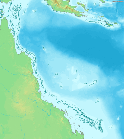
Map of Great Barrier Reef.

Bounding box West 142°, South -23°, East 155°, North -9°. Centre at 16.00000° S 148.50000° E.

Public domain This image is in the public domain because came from the site http://www.demis.nl/home/pages/Gallery/examples.htm and was released by the copyright holder. Permission is granted to copy, distribute and/or modify this map since it is based on free of copyright images from: www.demis.nl. See also approval email on de.wp and its clarification.

File history

Click on a date/time to view the file as it appeared at that time.

Date/Time Dimensions User Comment
current 16:11, 20 December 2006 945×1,058 (200 KB) Mats Halldin (Map of Great Barrier Reef. Bounding box West 142°, South -23°, East 155°, North -9°. Centre at {{coor d|16.00000|S|148.50000|E|scale:8400000}}. {{demis-pd}} Category:Maps of Australia )
The following pages on Schools Wikipedia link to this image (list may be incomplete):
The 2008 Wikipedia for Schools was sponsored by a UK Children's Charity, SOS Children UK , and consists of a hand selection from the English Wikipedia articles with only minor deletions (see www.wikipedia.org for details of authors and sources). See also our Disclaimer.