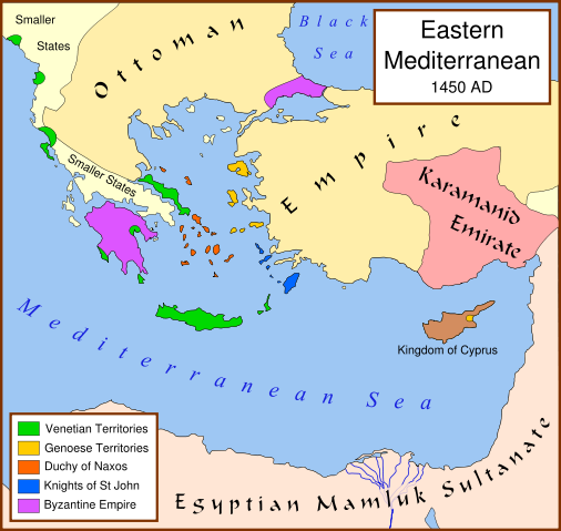
Image:Eastern Mediterranean 1450 .svg
From Wikipedia, the free encyclopedia

Eastern_Mediterranean_1450_.svg (SVG file, nominally 2,529 × 2,395 pixels, file size: 333 KB)
File history
Click on a date/time to view the file as it appeared at that time.
| Date/Time | Dimensions | User | Comment | |
|---|---|---|---|---|
| current | 16:15, 16 October 2007 | 2,529×2,395 (333 KB) | MapMaster | (small fix) |
| 18:56, 9 September 2007 | 2,529×2,395 (332 KB) | MapMaster | (Further slight changes, particularly Thessaloniki.) | |
| 04:23, 9 September 2007 | 2,529×2,395 (335 KB) | MapMaster | (More changes based on Alekkas' research.) | |
| 03:50, 7 September 2007 | 2,529×2,395 (348 KB) | MapMaster | (Slight modifications based on information from User:Alekkas on my talk page.) | |
| 03:08, 17 April 2007 | 2,529×2,395 (347 KB) | MapMaster | (Added missing text) | |
| 05:20, 14 April 2007 | 2,529×2,395 (321 KB) | MapMaster | (slight update) | |
| 20:52, 13 April 2007 | 2,529×2,395 (316 KB) | MapMaster | (A political map of the eastern Mediterranean Sea, in 1450. ) |
File links
The following pages on Schools Wikipedia link to this image (list may be incomplete):