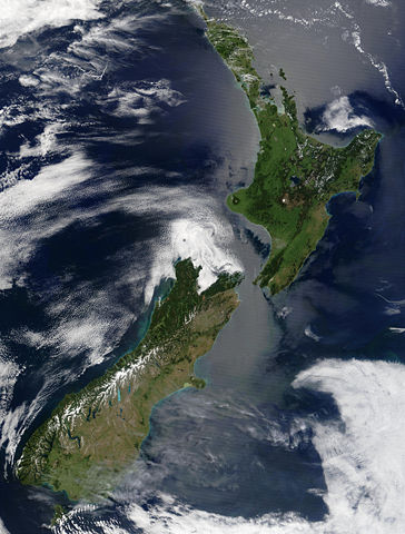
Image:Satellite image of New Zealand in December 2002.jpg
From Wikipedia, the free encyclopedia

Size of this preview: 364 × 480 pixels
Full resolution (4,400 × 5,800 pixels, file size: 3.39 MB, MIME type: image/jpeg)
File history
Click on a date/time to view the file as it appeared at that time.
| Date/Time | Dimensions | User | Comment | |
|---|---|---|---|---|
| current | 15:51, 3 May 2005 | 4,400×5,800 (3.39 MB) | Hautala | ({{PD-USGov-NASA}} Satellite image of New Zealand in December 2002. NASA's description: :These stunning true-colour images provide a rare, cloud-free look at the island nation of New Zealand, including most of its North and South Islands. This scene was ac) |
File links
The following pages on Schools Wikipedia link to this image (list may be incomplete):
Categories: Images of New Zealand

