Image:Greater Manchester outline map with UK.png
From Wikipedia, the free encyclopedia
Size of this preview: 640 × 446 pixels
Full resolution (800 × 558 pixels, file size: 453 KB, MIME type: image/png)
| |
This is a file from the Wikimedia Commons. The description on its description page there is shown below. |
Summary
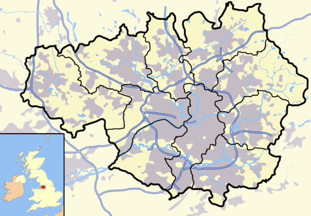
| Description |
A Map of Greater Manchester, UK. |
|---|---|
| Source |
Originally from en.wikipedia; description page is/was here. |
| Date |
2007-03-17 (first version); 2007-04-03 (last version) |
| Author |
Jhamez84 at en.wikipedia |
| Permission ( Reusing this image) |
Released into the public domain (by the author).
|
License information
 |
This image has been (or is hereby) released into the public domain by its author, Jhamez84 at the wikipedia project. This applies worldwide. In case this is not legally possible: |
Original upload log
(All user names refer to en.wikipedia)
- 2007-04-03 23:51 Jhamez84 800×558×8 (463953 bytes) Minor pantone adjustments to bring map inline with that of [[South Yorkshire]] etc
- 2007-03-28 13:08 Jhamez84 800×558×8 (498007 bytes) reducing urban area around Horwich per Google Maps
- 2007-03-22 07:25 Jhamez84 800×558×8 (497964 bytes) corrected Horwich area
- 2007-03-19 01:53 Jhamez84 800×558×8 (497969 bytes) thickened up UK map borders
- 2007-03-18 01:26 Jhamez84 800×558×8 (498689 bytes) more corrections (M6)
- 2007-03-18 01:17 Jhamez84 800×558×8 (496803 bytes) corrections
- 2007-03-18 00:56 Jhamez84 800×558×8 (496939 bytes) Yellowed background and expanded conurbation context
- 2007-03-17 01:39 Jhamez84 600×419×8 (244396 bytes) added box around county
- 2007-03-17 00:35 Jhamez84 600×419×8 (244388 bytes)
File history
Click on a date/time to view the file as it appeared at that time.
| Date/Time | Dimensions | User | Comment | |
|---|---|---|---|---|
| current | 15:26, 5 May 2007 | 800×558 (453 KB) | Pit-yacker | ({{Information |Description=''no original description'' |Source=Originally from [http://en.wikipedia.org en.wikipedia]; description page is/was [http://en.wikipedia.org/w/index.php?title=Image%3AGreater_Manchester_outline_map_with_UK.png here]. |Date=2007-) |
File links
The following pages on Schools Wikipedia link to this image (list may be incomplete):