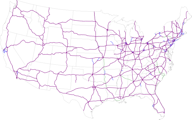
Image:Map of current Interstates.svg
From Wikipedia, the free encyclopedia

Map_of_current_Interstates.svg (SVG file, nominally 689 × 432 pixels, file size: 744 KB)
File history
Click on a date/time to view the file as it appeared at that time.
| Date/Time | Dimensions | User | Comment | |
|---|---|---|---|---|
| current | 06:12, 29 February 2008 | 689×432 (744 KB) | Alex43223 | (Updated a couple highways) |
| 02:38, 22 June 2007 | 689×432 (687 KB) | Krimpet | (Reverted to earlier revision) | |
| 02:37, 22 June 2007 | 689×432 (687 KB) | Krimpet | ({{spuimap}} Map of the present Interstate Highway System. Base map is [http://www.nationalatlas.gov/printable/images/pdf/reference/genref.pdf] (public domain US Federal Government). *Purple: two-digit *Blue: selected three-digit *Green: selected future ro) | |
| 16:07, 13 July 2006 | 689×432 (687 KB) | SPUI | ({{spuimap}}) |
File links
The following pages on Schools Wikipedia link to this image (list may be incomplete):
