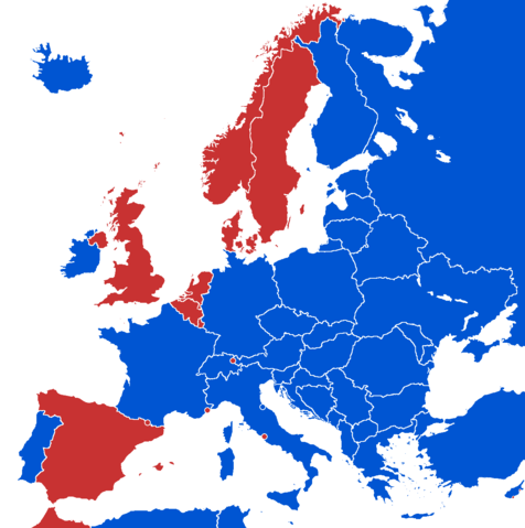
Image:European states by head of state.png
From Wikipedia, the free encyclopedia

Size of this preview: 476 × 479 pixels
Full resolution (1,236 × 1,245 pixels, file size: 93 KB, MIME type: image/png)
File history
Click on a date/time to view the file as it appeared at that time.
| Date/Time | Dimensions | User | Comment | |
|---|---|---|---|---|
| current | 22:29, 5 July 2008 | 1,236×1,245 (93 KB) | Avala | |
| 16:33, 13 March 2008 | 1,236×1,245 (94 KB) | Nightstallion | (upload a variant if you wish, but the majority in Europe recognises or will recognise.) | |
| 18:11, 11 March 2008 | 1,236×1,245 (93 KB) | Avala | (Spain has a different view therefore we can't make this map final in that way) | |
| 18:38, 25 February 2008 | 1,236×1,245 (94 KB) | Hoshie | (added Kosovo after a request; fixed Gibraltar, Ceuta and Melilla, and the SBAs ) | |
| 11:42, 4 April 2007 | 1,236×1,245 (93 KB) | Nightstallion | (==Summary== {{legend|#C83232|monarchy}} {{legend|#0055D2| republic}} == Licensing == {{GFDL-en}} Category:Maps of the European Union ) |
File links
The following pages on Schools Wikipedia link to this image (list may be incomplete):
