From Wikipedia, the free encyclopedia
 |
This is a file from the Wikimedia Commons. The description on its description page there is shown below.Commons is a freely licensed media file repository. You can help.
|
| Camera location |
53.33571° N, 6.19837° W 53.33571;-6.19837 |
See this image at its location on Google Maps This location on: Live Maps - Trails.com - TerraServer-USA |
| Description |
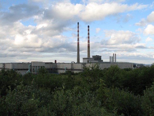
Ringsend Power Station from the Irishtown Nature Park near to Sandymount and Donnybrook, Dublin, Ireland. Geographical data: Subject location Irish: O2009033226 [Accurate to ~1m] WGS84: 53:20.1423N 6:11.9022W [53.33571,-6.19837] View direction: Northeast (about 45 degrees). |
| Source |
Geograph British Isles |
| Date |
Image taken Monday, 19 June, 2006 |
| Author |
Doug Lee |
Permission
( Reusing this image) |
Copyright information from http://www.geograph.org.uk/faq.php: "Images are licenced for re-use under a Creative Commons Licence, see licence details by viewing a full size image."
|
Licensing
| This image was taken from the Geograph project collection. See this photograph's page on the Geograph website for the photographer's contact details. The copyright on this image is owned by Doug Lee and is licensed for reuse under the Creative Commons Attribution-ShareAlike 2.0 license. |

  |
This file is licensed under Creative Commons Attribution ShareAlike 2.0 License (cc-by-sa-2.0). In short: you are free to share and make derivative works of the file under the conditions that you appropriately attribute it, and that you distribute it under this or a similar cc-by-sa license.
|
File history
Click on a date/time to view the file as it appeared at that time.
|
|
Date/Time |
Dimensions |
User |
Comment |
| current |
15:24, 13 September 2006 |
640×480 (68 KB) |
Alnaschar |
|
File links
The following pages on Schools Wikipedia link to this image (list may be incomplete):
