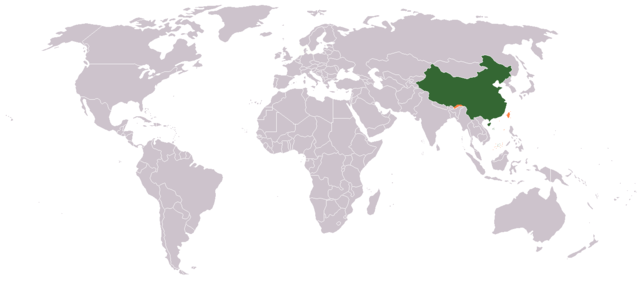
Image:LocationPRChina.png
From Wikipedia, the free encyclopedia

Size of this preview: 640 × 282 pixels
Full resolution (1,427 × 628 pixels, file size: 48 KB, MIME type: image/png)
File history
Click on a date/time to view the file as it appeared at that time.
| Date/Time | Dimensions | User | Comment | |
|---|---|---|---|---|
| current | 23:42, 15 May 2008 | 1,427×628 (48 KB) | Shibo77 | (Reverted to version as of 10:09, 4 May 2008) |
| 15:06, 14 May 2008 | 1,427×628 (48 KB) | Jabchinkyass | (Reverted to version as of 19:07, 15 April 2008) | |
| 10:09, 4 May 2008 | 1,427×628 (48 KB) | Shibo77 | ||
| 06:18, 4 May 2008 | 1,427×628 (48 KB) | Lauyulam | ({{Information |Description= |Source= |Date= |Author= |Permission= |other_versions= }} ) | |
| 21:34, 26 April 2008 | 1,427×628 (48 KB) | Shibo77 | (Changed to colours more noticeable: *Orange - Claimed by the PR China, not administered by the PR China **(Arunachal Pradesh, Diaoyutai island, the Kinmen islands, the Matsu islands, the Penghu archipelago, the Pratas Islands, Scarborough Shoal, Shaksgam ) | |
| 19:07, 15 April 2008 | 1,427×628 (48 KB) | Nat | ({{Information |Description= Location of the People's Republic of China |Source= en.wikipedia.org |Date= Uploaded to Commons on ~~~~~ |Author= Users of en.wikipedia |other_versions= }} == Wikipedia edit history == ) | |
| 11:01, 26 March 2008 | 1,427×628 (47 KB) | Lauyulam | ({{Information |Description= |Source= |Date= |Author= |Permission= |other_versions= }} ) | |
| 11:00, 26 March 2008 | 1,427×628 (47 KB) | Lauyulam | ({{Information |Description= |Source= |Date= |Author= |Permission= |other_versions= }} ) | |
| 11:01, 9 June 2006 | 1,427×628 (29 KB) | Aivazovsky | ||
| 15:02, 1 February 2006 | 1,357×628 (14 KB) | Kibinsky | (borders of former USSR member republics disappeared - correction, and reduce file size.) | |
| 17:03, 29 August 2005 | 1,357×628 (20 KB) | Elephantus | (Changed from light blue to the more usual dark green.) | |
| 02:53, 15 August 2005 | 1,357×628 (22 KB) | R.O.C | (Location map for the People's Republic of China (actually controlled land only, excluding claims). 中華人民共和國(實際控制區)位置圖。 {{GFDL}} Created by fakie from the German Wikipedia modified by) | |
| 01:49, 15 August 2005 | 1,357×628 (45 KB) | Fakie | ({{GFDL}} larger pic, created by fakie (de)) | |
| 16:31, 12 July 2005 | 250×115 (19 KB) | Mosesofmason | (more sharp & clear) | |
| 16:12, 12 July 2005 | 250×115 (19 KB) | Mosesofmason | (add hai-nan island) | |
| 02:51, 23 December 2004 | 250×115 (17 KB) | EugeneZelenko | (Location map for the People's Republic of China.<br/>Originally created for English Wikipedia by Vardion.<br/>{{PD}}<br/> Category:Country locator maps) |
File links
The following pages on Schools Wikipedia link to this image (list may be incomplete):


