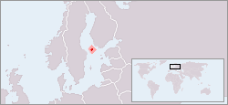
Image:LocationAland.png
From Wikipedia, the free encyclopedia

No higher resolution available.
LocationAland.png (250 × 115 pixels, file size: 14 KB, MIME type: image/png)
File history
Click on a date/time to view the file as it appeared at that time.
| Date/Time | Dimensions | User | Comment | |
|---|---|---|---|---|
| current | 17:26, 23 July 2007 | 250×115 (14 KB) | Pudeo | ( Image:Åland map with borders.svg) |
| 05:25, 30 October 2006 | 250×115 (9 KB) | Huhsunqu | ||
| 12:46, 28 July 2006 | 250×115 (11 KB) | J. Patrick Fischer | (Location map for Åland Islands {{Information |Description=Location of Aland Islands. |Source=old version edited wwith better colours |Date=28th july 2006 |Author=J. Patrick Fischer |Permission=free |other_versions=Original User:Vardion }} {{PD-user|us) | |
| 19:06, 2 March 2006 | 250×115 (10 KB) | J. Patrick Fischer | (Location of Aland. Created by User:Vardion. Modified by User:J. Patrick Fischer) | |
| 19:02, 2 March 2006 | 250×115 (10 KB) | J. Patrick Fischer | (Location of Aland. Created by User:Vardion. Modified by User:J. Patrick Fischer) | |
| 05:09, 2 March 2005 | 250×115 (14 KB) | Ultratomio | (location map for Åland Originally created for English Wikipedia by Vardion. {{PD}}) |
File links
The following pages on Schools Wikipedia link to this image (list may be incomplete):
Categories: Maps of Åland