From Wikipedia, the free encyclopedia
 |
This is a file from the Wikimedia Commons. The description on its description page there is shown below.Commons is a freely licensed media file repository. You can help.
|
 |
This is a featured picture, which means that members of the community have identified it as one of the finest images on the English Wikipedia, adding significantly to its accompanying article. If you have a different image of similar quality, be sure to upload it using the proper free license tag, add it to a relevant article, and nominate it. |
 |
This is a featured picture on English Wikipedia and is considered one of the finest images.
- If you think this file should be featured on Wikimedia Commons as well, feel free to nominate it.
- If you have an image of similar quality that can be published under a suitable copyright license, be sure to upload it, tag it, and nominate it.
|
 |
Summary
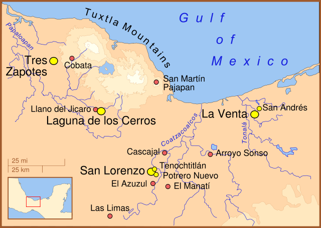
A map of the Olmec heartland. The yellow sites are known villages and towns. The smaller red dots mark locations where artifacts or art have been found unassociated with habitation. The river courses and shorelines are modern, as are the names (we don't know the names the Olmecs used).
Note: This is another version of Image:Olmec Heartland Overview v2.svg
Other versions
Part of a series:
Formative Period sites in Central Mexico
|
Formative Period sites in Southeastern Mesoamerica
|
Map of the Olmec Heartland
|
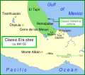
Classic era sites in Central Mexico
|
Site with early evidence for ballplaying
|
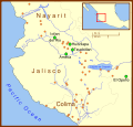
Western Mexico archaeological sites
|
References
- Arnold III, Philip J. (2002) Location of Isla Agaltepec in the Tuxtla Mountains, Veracruz, Mexico., in "Isla Agaltepec: Postclassic Occupation in the Tuxtla Mountains, Veracruz, México", accessed June 2007 (for elevations).
- Coe, Michael; Snow, Dean; Benson, Elizabeth; (1986) Atlas of Ancient America; Facts on File, New York, pp. 94-95, (for the locations of the sites).
- Diehl, Richard A. (2004) The Olmecs: America's First Civilization, Thames & Hudson, London, p.12.
- Rodríguez Martínez, Ma. del Carmen;Ortíz Ceballos, Ponciano; Coe, Michael D.; Diehl, Richard A.; Houston, Stephen D.; Taube, Karl A.; Calderón, Alfredo Delgado (2006) "Oldest Writing in the New World" in Science, Vol. 313. no. 5793, pp. 1610-1614 (for location of Cascajal).
- Pool, Christopher A. (2007). Olmec Archaeology and Early Mesoamerica. Cambridge: Cambridge University Press. (for location of Cobata and Llano del Jicaro)
Licensing
I, the copyright holder of this work, hereby publish it under the following licenses:
 |
Permission is granted to copy, distribute and/or modify this document under the terms of the GNU Free Documentation license, Version 1.2 or any later version published by the Free Software Foundation; with no Invariant Sections, no Front-Cover Texts, and no Back-Cover Texts. A copy of the license is included in the section entitled " GNU Free Documentation license".
Aragonés | العربية | Asturianu | Беларуская (тарашкевіца) | Български | বাংলা | ইমার ঠার/বিষ্ণুপ্রিয়া মণিপুরী | Brezhoneg | Bosanski | Català | Cebuano | Česky | Dansk | Deutsch | Ελληνικά | English | Esperanto | Español | Eesti | Euskara | فارسی | Suomi | Français | Gaeilge | Galego | עברית | Hrvatski | Magyar | Bahasa Indonesia | Ido | Íslenska | Italiano | 日本語 | ქართული | ភាសាខ្មែរ | 한국어 | Kurdî / كوردی | Latina | Lëtzebuergesch | Lietuvių | Bahasa Melayu | Nnapulitano | Nederlands | Norsk (nynorsk) | Norsk (bokmål) | Occitan | Polski | Português | Română | Русский | Slovenčina | Slovenščina | Shqip | Српски / Srpski | Svenska | తెలుగు | ไทย | Tagalog | Türkçe | Українська | اردو | Tiếng Việt | Volapük | Yorùbá | 中文(简体) | 中文(繁體) | +/- |

 |
This file is licensed under the Creative Commons Attribution 3.0 Unported License. In short: you are free to distribute and modify the file as long as you attribute its author(s) or licensor(s). Official license
Català | Česky | Deutsch | English | Ελληνικά | Español | Français | 한국어 | Italiano | עברית | Lietuvių | Magyar | Nederlands | Polski | Português | Русский | Türkçe | 中文(繁體) | +/- |
You may select the license of your choice.
|
File history
Click on a date/time to view the file as it appeared at that time.
|
|
Date/Time |
Dimensions |
User |
Comment |
| current |
01:03, 30 December 2007 |
1,788×1,273 (257 KB) |
Madman2001 |
|
|
|
18:52, 7 December 2007 |
1,788×1,273 (255 KB) |
Madman2001 |
|
File links
The following pages on Schools Wikipedia link to this image (list may be incomplete):


