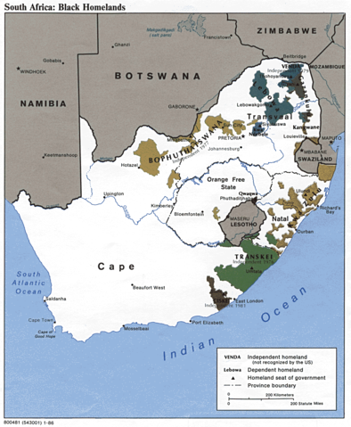
Image:Southafricanhomelandsmap.png
From Wikipedia, the free encyclopedia

Size of this preview: 394 × 479 pixels
Full resolution (1,014 × 1,234 pixels, file size: 330 KB, MIME type: image/png)
File history
Click on a date/time to view the file as it appeared at that time.
| Date/Time | Dimensions | User | Comment | |
|---|---|---|---|---|
| current | 20:44, 24 November 2005 | 1,014×1,234 (330 KB) | Dbenbenn | (Reverted to earlier revision) |
| 07:03, 13 November 2005 | 1,014×1,234 (330 KB) | Hannah | (File history Legend: (cur) = this is the current file, (del) = delete this old version, (rev) = revert to this old version. Click on date to download the file or see the image uploaded on that date. (del) (cur) 15:38, 1 September 2005 . . AlbertR . . 10) |
File links
The following pages on Schools Wikipedia link to this image (list may be incomplete):

