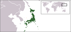
Image:LocationMapJapan.png
From Wikipedia, the free encyclopedia

No higher resolution available.
LocationMapJapan.png (250 × 115 pixels, file size: 5 KB, MIME type: image/png)
File history
Click on a date/time to view the file as it appeared at that time.
| Date/Time | Dimensions | User | Comment | |
|---|---|---|---|---|
| current | 05:57, 23 July 2008 | 250×115 (5 KB) | Dane Rider | (Reverted to version as of 05:54, 23 July 2008) |
| 05:56, 23 July 2008 | 250×115 (5 KB) | Dane Rider | (Reverted to version as of 05:52, 23 July 2008) | |
| 05:54, 23 July 2008 | 250×115 (5 KB) | Dane Rider | ||
| 05:52, 23 July 2008 | 250×115 (5 KB) | Dane Rider | ({{Information |Description= |Source= |Date= |Author= |Permission= |other_versions= }}) | |
| 13:13, 14 June 2008 | 250×115 (5 KB) | Boushi | (Reverted to version as of 16:49, 6 June 2008) | |
| 05:45, 13 June 2008 | 250×115 (5 KB) | Lauyulam | ({{Information |Description=LocationMapJapan |Source=me |Date=13/6/08 |Author=me |Permission=see below |other_versions=no }}) | |
| 16:49, 6 June 2008 | 250×115 (5 KB) | Shibo77 | ({{Information |Description= |Source= |Date= |Author= |Permission= |other_versions= }}) | |
| 22:48, 8 May 2008 | 250×115 (5 KB) | Shibo77 | (Claimed territories in orange.) | |
| 23:48, 21 February 2008 | 250×115 (6 KB) | Csman | (Reverted to version as of 09:57, 13 October 2007) | |
| 01:27, 2 February 2008 | 250×115 (6 KB) | Smith2007 | (Reverted to version as of 09:18, 26 May 2007) | |
| 01:27, 2 February 2008 | 250×115 (6 KB) | Smith2007 | (Reverted to version as of 06:55, 30 September 2007) | |
| 09:57, 13 October 2007 | 250×115 (6 KB) | Csman | (Reverted to version as of 17:10, 31 August 2007) | |
| 06:55, 30 September 2007 | 250×115 (6 KB) | Smith2007 | (Reverted to version as of 09:18, 26 May 2007) | |
| 17:10, 31 August 2007 | 250×115 (6 KB) | Csman | (Reverted to version as of 05:12, 21 March 2007) | |
| 09:18, 26 May 2007 | 250×115 (6 KB) | Smith2007 | (Reverted to earlier revision) | |
| 05:12, 21 March 2007 | 250×115 (6 KB) | ChongDae | (Reverted to earlier revision) | |
| 15:04, 8 February 2007 | 838×601 (46 KB) | Jrockley | ||
| 16:05, 3 August 2006 | 250×115 (6 KB) | Kfkf | (Reverted to earlier revision) | |
| 16:04, 3 August 2006 | 250×115 (6 KB) | Kfkf | (Reverted to earlier revision) | |
| 09:00, 6 June 2006 | 250×115 (6 KB) | Csman | (Reverted to earlier revision) | |
| 08:11, 6 June 2006 | 250×115 (6 KB) | Moja | (以前のバージョンへの差し戻し (Reverted to earlier revision)) | |
| 07:19, 4 June 2006 | 250×115 (6 KB) | Csman | (== Summary == I edited Public Domain one. Old one did not have right shape of main island and there was no Okinawa(Ryukyu) Isl too. For old one, please check link called "English" on Left hand side. == Licensing == {{PD-self}} [[Category:Locator maps for) | |
| 06:45, 15 March 2006 | 250×115 (6 KB) | V6g3h7 | (I edited Public Domain one. Old one did not have right shape of main island and there was no Okinawa(Ryukyu) Isl too.) |
File links
The following pages on Schools Wikipedia link to this image (list may be incomplete):
