From Wikipedia, the free encyclopedia
 Size of this preview: 640 × 440 pixels
 Full resolution (1,400 × 962 pixels, file size: 582 KB, MIME type: image/jpeg)
 |
This is a file from the Wikimedia Commons. The description on its description page there is shown below.Commons is a freely licensed media file repository. You can help.
|
 |
Permission is granted to copy, distribute and/or modify this map under the terms of the GNU Free Documentation License, Version 1.2 or any later version published by the Free Software Foundation; with no Invariant Sections, no Front-Cover Texts, and no Back-Cover Texts. A copy of the license is included in the section entitled " GNU Free Documentation License".
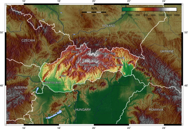
The map has been created with the Generic Mapping Tools: http://gmt.soest.hawaii.edu/ using one or more of these public domain datasets for the relief:
- ETOPO2 ( topography/ bathymetry): http://www.ngdc.noaa.gov/mgg/global/global.html
- GLOBE ( topography): http://www.ngdc.noaa.gov/mgg/topo/globe.html
- SRTM ( topography): http://www2.jpl.nasa.gov/srtm/
|
|
File history
Click on a date/time to view the file as it appeared at that time.
|
|
Date/Time |
Dimensions |
User |
Comment |
| current |
18:01, 26 December 2005 |
1,400×962 (582 KB) |
Captain Blood |
|
File links
The following pages on Schools Wikipedia link to this image (list may be incomplete):

