Image:Khazarfall.png
From Wikipedia, the free encyclopedia

No higher resolution available.
Khazarfall.png (593 × 447 pixels, file size: 24 KB, MIME type: image/png)
File history
Click on a date/time to view the file as it appeared at that time.
| Date/Time | Dimensions | User | Comment | |
|---|---|---|---|---|
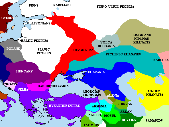
| current | 20:55, 29 May 2007 | 593×447 (24 KB) | Briangotts | (== Beschreibung == Khazaria and surrounding states, c. w:950 CE. == Licensing == Created by Briangotts Category:History maps by User:Briangotts Category:Maps of the Khazars [[Category:Maps of the history) |
| 15:17, 11 April 2007 | 593×447 (24 KB) | Briangotts | ( Khazaria and surrounding states, c. w:950 CE. ==Sources== *Haywood, John, ''et al. The Cassell Atlas of World History''. Andromeda Oxford Ltd., 1997. * Kevin Alan Brook. ''The Jews of Khazaria.'' 2nd ed. Rowman & Littlefield Publishe) | |
| 21:02, 17 January 2006 | 450×345 (14 KB) | Jrohr | ( Khazaria and surrounding states, c. 950 CE. Category:Historical maps by User:Briangotts == Licensing == ) |
File links
The following pages on Schools Wikipedia link to this image (list may be incomplete):
Categories: Maps of the history of Russia

