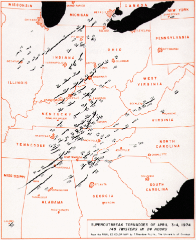
Image:Super Outbreak Map.PNG
From Wikipedia, the free encyclopedia

Size of this preview: 391 × 479 pixels
Full resolution (591 × 724 pixels, file size: 200 KB, MIME type: image/png)
File history
Click on a date/time to view the file as it appeared at that time.
| Date/Time | Dimensions | User | Comment | |
|---|---|---|---|---|
| current | 16:02, 18 March 2006 | 591×724 (200 KB) | Achim Raschka | (Tracks of tornadoes generated during the 1974 Super Outbreak. From the [http://www.spc.noaa.gov/publications/corfidi/74outbreak_slides/ Storm Prediction Centre] Category:Tornadoes en:Super_Outbreak_Map.PNG {{PD-USGov-NOAA}} ) |
File links
The following pages on Schools Wikipedia link to this image (list may be incomplete):

