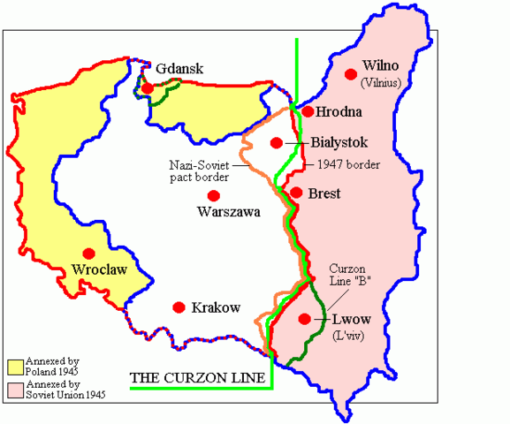
Image:Map of Poland (1945).png
From Wikipedia, the free encyclopedia

Size of this preview: 577 × 480 pixels
Full resolution (617 × 513 pixels, file size: 9 KB, MIME type: image/png)
File history
Click on a date/time to view the file as it appeared at that time.
| Date/Time | Dimensions | User | Comment | |
|---|---|---|---|---|
| current | 07:58, 12 February 2007 | 617×513 (9 KB) | Unomano | (Map of Poland in 1945, drawn by en:User: Adam Carr. From en:Image:Map of Poland (1945).png {{PD-user-w|en|English Wikipedia|Adam Carr}} Category:Maps of the history of Poland ) |
| 14:43, 2 December 2005 | 617×513 (9 KB) | Thuresson | (Map of Poland in 1945, drawn by User: Adam Carr. From en:Image:Map of Poland (1945).png {{PD-user-w|en|English Wikipedia|Adam Carr}} Category:Historical maps of Poland) |
File links
The following pages on Schools Wikipedia link to this image (list may be incomplete):

