Image:Satellite image of Europoort, Netherlands (4.25E 51.90N).png
From Wikipedia, the free encyclopedia
Size of this preview: 640 × 439 pixels
Full resolution (1,024 × 702 pixels, file size: 1.59 MB, MIME type: image/png)
| |
This is a file from the Wikimedia Commons. The description on its description page there is shown below. |
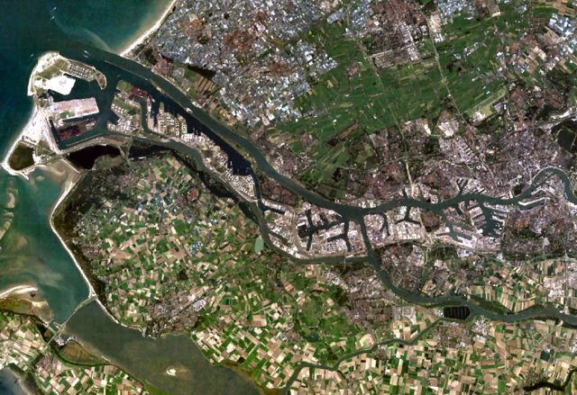
Satellite image of the Europoort, a port near Rotterdam, The Netherlands.
Screenshot from NASA's World Wind.
 |
This image is in the public domain because it is a screenshot from NASA’s globe software World Wind using Blue Marble, Landsat or USGS layer, all of which are in public domain. |
|
File history
Click on a date/time to view the file as it appeared at that time.
| Date/Time | Dimensions | User | Comment | |
|---|---|---|---|---|
| current | 18:19, 7 May 2007 | 1,024×702 (1.59 MB) | P199 | (Retouched photo with increased lightness and clarity.) |
| 14:47, 14 August 2005 | 1,024×702 (1.27 MB) | Harmil | (Just lightened the image a touch to make it visible when thumbnailed.) | |
| 12:44, 4 May 2005 | 1,024×702 (1.28 MB) | Galwaygirl | (Satellite image of the Europoort, a port near Rotterdam, The Netherlands. Screenshot from NASA's World Wind. {{PD}}) |
File links
The following pages on Schools Wikipedia link to this image (list may be incomplete):