Image:Kerala density map1.PNG
From Wikipedia, the free encyclopedia

No higher resolution available.
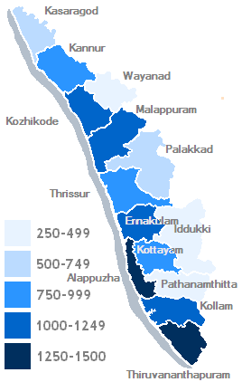
Kerala_density_map1.PNG (268 × 422 pixels, file size: 12 KB, MIME type: image/png)
File history
Click on a date/time to view the file as it appeared at that time.
| Date/Time | Dimensions | User | Comment | |
|---|---|---|---|---|
| current | 00:26, 18 January 2006 | 268×422 (12 KB) | Saravask | (== Summary == == Description == Population density from darkest shading (most dense) to lightest (least dense). Bins (inhabitants per km<sup>2</sup>): 250–500; 500–750; 750–1000; 1000–1250; 1250–1500 Data from [http://www.ke) |
File links
The following pages on Schools Wikipedia link to this image (list may be incomplete):
