Image:Black Sea map.png
From Wikipedia, the free encyclopedia
Size of this preview: 629 × 480 pixels
Full resolution (1,200 × 915 pixels, file size: 374 KB, MIME type: image/png)
| |
This is a file from the Wikimedia Commons. The description on its description page there is shown below. |
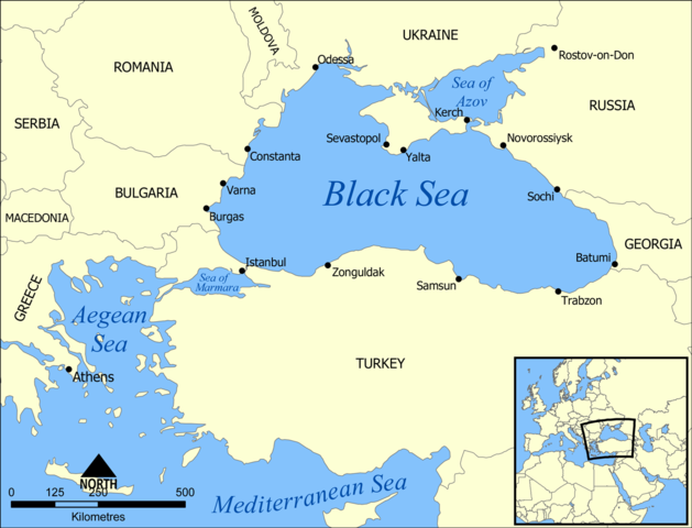
A map showing the location of the Black Sea and some of the large or prominent ports around it. The Sea of Azov and Sea of Marmara are also labelled.
Created by NormanEinstein, July 25, 2005.
|

File history
Click on a date/time to view the file as it appeared at that time.
| Date/Time | Dimensions | User | Comment | |
|---|---|---|---|---|
| current | 18:10, 10 July 2007 | 1,200×915 (374 KB) | NormanEinstein | (Updated maps to add Russian city of Sochi.) |
| 19:11, 7 May 2007 | 1,200×912 (370 KB) | NormanEinstein | (Corrected city name typo.) | |
| 13:10, 29 May 2006 | 1,200×914 (133 KB) | NormanEinstein | (Reduced image size.) | |
| 14:54, 25 July 2005 | 1,200×916 (476 KB) | NormanEinstein | (A map showing the location of the Black Sea and some of the large or prominent ports around it. The Sea of Azov and Sea of Maramara are also labelled. Created by NormanEinstein, July 25, 2005. {{GFDL-self}} Category:Maps of seas) |