Image:Cetacea range map Sperm Whale 4.PNG
From Wikipedia, the free encyclopedia
Size of this preview: 640 × 296 pixels
Full resolution (1,357 × 628 pixels, file size: 35 KB, MIME type: image/png)
| |
This is a file from the Wikimedia Commons. The description on its description page there is shown below. |
Extracted from the English Wikipedia.
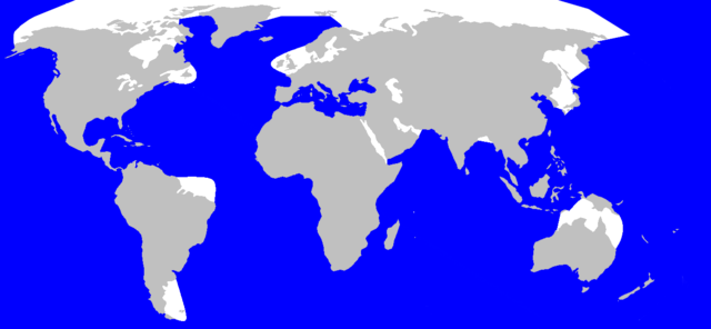
| Description | Geographic distribution of Spermwhale v4 Português: Distribuição geográfica da Cachalote
|
|---|---|
| Source | |
| Date |
17. June 2006 |
| Author |
en:User:Vardion, en:User:Pcb21 and en:User:Chris huh |
| Permission ( Reusing this image) |
GFDL
|
 |
Permission is granted to copy, distribute and/or modify this document under the terms of the GNU Free Documentation license, Version 1.2 or any later version published by the Free Software Foundation; with no Invariant Sections, no Front-Cover Texts, and no Back-Cover Texts. A copy of the license is included in the section entitled " GNU Free Documentation license". Aragonés | العربية | Asturianu | Беларуская (тарашкевіца) | Български | বাংলা | ইমার ঠার/বিষ্ণুপ্রিয়া মণিপুরী | Brezhoneg | Bosanski | Català | Cebuano | Česky | Dansk | Deutsch | Ελληνικά | English | Esperanto | Español | Eesti | Euskara | فارسی | Suomi | Français | Gaeilge | Galego | עברית | Hrvatski | Magyar | Bahasa Indonesia | Ido | Íslenska | Italiano | 日本語 | ქართული | ភាសាខ្មែរ | 한국어 | Kurdî / كوردی | Latina | Lëtzebuergesch | Lietuvių | Bahasa Melayu | Nnapulitano | Nederlands | Norsk (nynorsk) | Norsk (bokmål) | Occitan | Polski | Português | Română | Русский | Slovenčina | Slovenščina | Shqip | Српски / Srpski | Svenska | తెలుగు | ไทย | Tagalog | Türkçe | Українська | اردو | Tiếng Việt | Volapük | Yorùbá | 中文(简体) | 中文(繁體) | +/- |
User:Pcb21 after User:Vardion, Sperm Whale range map v.4
See also: Wikipedia:WikiProject Cetaceans#Range maps
File history
Click on a date/time to view the file as it appeared at that time.
| Date/Time | Dimensions | User | Comment | |
|---|---|---|---|---|
| current | 13:44, 14 September 2006 | 1,357×628 (35 KB) | Stigmj | ({{Information |Description=Geographic distribution of Spermwhale v4 |Source= en:Image:Cetacea_range_map_Sperm_Whale_4.PNG |Date=17. June 2006 |Author= en:User:Vardion, en:User:Pcb21 and en:User:Chris huh |Permission=GFDL }}) |
| 15:38, 26 March 2005 | 1,357×628 (35 KB) | David | (Extracted from the English Wikipedia. {{GFDL}} User:Pcb21 after User:Vardion, Sperm Whale range map v.4 See also: Wikipedia:WikiProject Cetaceans#Range maps) |