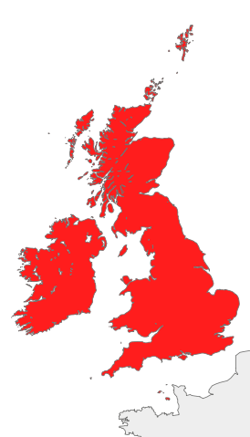
Image:British Isles all.svg
From Wikipedia, the free encyclopedia

British_Isles_all.svg (SVG file, nominally 675 × 1,180 pixels, file size: 136 KB)
File history
Click on a date/time to view the file as it appeared at that time.
| Date/Time | Dimensions | User | Comment | |
|---|---|---|---|---|
| current | 18:30, 20 October 2007 | 675×1,180 (136 KB) | Cnbrb | (== Summary == {{Information |Description=map of Great Britain and Ireland, also known collectively as the British Isles, or the Islands of the North Atlantic |Source=self-made |Date=2007-20-09 |Author= Cnbrb }} ) |
| 18:28, 20 October 2007 | 675×1,180 (136 KB) | Cnbrb | (== Summary == {{Information |Description=map of Great Britain and Ireland, also known collectively as the British Isles, or the Islands of the North Atlantic |Source=self-made |Date=2007-20-09 |Author= Cnbrb }} ) | |
| 18:27, 20 October 2007 | 675×1,180 (136 KB) | Cnbrb | (== Summary == {{Information |Description=map of Great Britain and Ireland, also known collectively as the British Isles, or the Islands of the North Atlantic |Source=self-made |Date=2007-20-09 |Author= Cnbrb }} ) | |
| 18:26, 20 October 2007 | 675×1,180 (136 KB) | Cnbrb | (== Summary == {{Information |Description=map of Great Britain and Ireland, also known collectively as the British Isles, or the Islands of the North Atlantic |Source=self-made |Date=2007-20-09 |Author= Cnbrb }} ) | |
| 18:14, 20 October 2007 | 675×1,180 (310 KB) | Cnbrb | (== Summary == {{Information |Description=map of Great Britain and Ireland, also known collectively as the British Isles, or the Islands of the North Atlantic |Source=self-made |Date=2007-10-09 |Author= Cnbrb }} ) | |
| 18:10, 20 October 2007 | 675×1,180 (619 KB) | Cnbrb | (== Summary == {{Information |Description=map of Great Britain and Ireland, also known collectively as the British Isles, or the Islands of the North Atlantic |Source=self-made |Date=2007-10-09 |Author= Cnbrb }} ) | |
| 18:08, 20 October 2007 | 675×1,180 (618 KB) | Cnbrb | (== Summary == {{Information |Description=map of Great Britain and Ireland, also known collectively as the British Isles, or the Islands of the North Atlantic |Source=self-made |Date=2007-10-09 |Author= Cnbrb }} ) | |
| 18:04, 20 October 2007 | 675×1,180 (618 KB) | Cnbrb | (== Summary == {{Information |Description=map of Great Britain and Ireland, also known collectively as the British Isles, or the Islands of the North Atlantic |Source=self-made |Date=2007-10-09 |Author= Cnbrb }} ) |
File links
The following pages on Schools Wikipedia link to this image (list may be incomplete):
