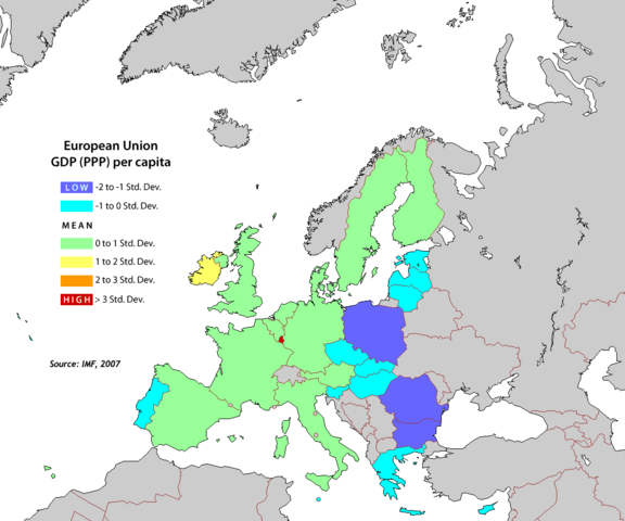
Image:EU-GDP-PPP-pc-map.png
From Wikipedia, the free encyclopedia

Size of this preview: 576 × 480 pixels
Full resolution (1,104 × 920 pixels, file size: 32 KB, MIME type: image/png)
File history
Click on a date/time to view the file as it appeared at that time.
| Date/Time | Dimensions | User | Comment | |
|---|---|---|---|---|
| current | 08:25, 11 June 2008 | 1,104×920 (32 KB) | Brybry26 | |
| 23:08, 19 June 2007 | 1,104×920 (66 KB) | Aivazovsky | ||
| 15:08, 30 December 2006 | 800×600 (116 KB) | Palazov | (update) | |
| 09:44, 29 December 2006 | 800×600 (55 KB) | Palazov | (updated to include BG and RO) | |
| 07:55, 15 January 2006 | 800×600 (55 KB) | Ronline | (GDP per capita (PPP) map, standard deviation for EU members. Originally made by User:Cantus and uploaded to English Wikipedia at [http://en.wikipedia.org/wiki/Image:EU-GDP-PPP-pc-map.png]. Updated to 2006 figures by myself. Category:Maps of Europe) | |
| 15:52, 6 December 2005 | 800×600 (47 KB) | Barfoos | (Done by User:Cantus {{GFDL}} Category:Maps of Europe ) |
File links
The following pages on Schools Wikipedia link to this image (list may be incomplete):
Categories: Maps of the European Union
