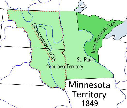
Image:Minnesotaterritory.PNG
From Wikipedia, the free encyclopedia

No higher resolution available.
Minnesotaterritory.PNG (524 × 446 pixels, file size: 83 KB, MIME type: image/png)
File history
Click on a date/time to view the file as it appeared at that time.
| Date/Time | Dimensions | User | Comment | |
|---|---|---|---|---|
| current | 09:45, 5 October 2006 | 524×446 (83 KB) | Conscious | (newest version from en:) |
| 02:49, 25 June 2006 | 439×313 (39 KB) | Starscream | ( Category:Maps of Missouri from: http://en.wikipedia.org/w/index.php?title=Image:Minnesotaterritory.PNG&action=submit) |
File links
The following pages on Schools Wikipedia link to this image (list may be incomplete):
Categories: Historical maps of the United States | Minnesota maps