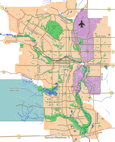
Image:Calgary street map.png
From Wikipedia, the free encyclopedia

Size of this preview: 386 × 479 pixels
Full resolution (960 × 1,192 pixels, file size: 802 KB, MIME type: image/png)
File history
Click on a date/time to view the file as it appeared at that time.
| Date/Time | Dimensions | User | Comment | |
|---|---|---|---|---|
| current | 18:31, 7 October 2007 | 960×1,192 (802 KB) | Qyd | (fix highway name) |
| 19:44, 18 April 2007 | 960×1,192 (791 KB) | Qyd | (spelling) | |
| 17:28, 18 September 2006 | 960×1,192 (792 KB) | Qyd | (outline industrial areas) | |
| 17:20, 16 August 2006 | 960×1,192 (802 KB) | Qyd | (added airport symbol and highway shields) | |
| 15:21, 14 August 2006 | 960×1,192 (797 KB) | Qyd | (fixed interchanges) | |
| 04:46, 14 August 2006 | 960×1,192 (700 KB) | Qyd | (added city parks) | |
| 04:19, 14 August 2006 | 960×1,192 (645 KB) | Qyd | (highways names added) | |
| 00:17, 14 August 2006 | 960×1,192 (491 KB) | Qyd | ({{Information |Description= Outline map of Calgary |Source=GIS data |Date=Aug 2006 |Author= Qyd |Permission=All |other_versions= Image:CalgaryAB-map.png }} Category:Calgary Category:Maps of cities in Canada) |
File links
The following pages on Schools Wikipedia link to this image (list may be incomplete):
