Image:Subtes-2007.svg
From Wikipedia, the free encyclopedia

Subtes-2007.svg (SVG file, nominally 1,600 × 1,200 pixels, file size: 89 KB)
File history
Click on a date/time to view the file as it appeared at that time.
| Date/Time | Dimensions | User | Comment | |
|---|---|---|---|---|
| current | 17:23, 12 May 2007 | 1,600×1,200 (89 KB) | Galio | |
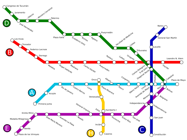
| 17:22, 12 May 2007 | 1,600×1,200 (88 KB) | Galio | (== Sumario == Mapa de la red de subterráneos de la Ciudad de Buenos Aires operativa a 2007, habiéndose inaugurado el primer tramo de la línea H. == Licensing == {{self2|GFDL|cc-by-2.5}} Category:Buenos Aires Metro ) |
File links
The following pages on Schools Wikipedia link to this image (list may be incomplete):
