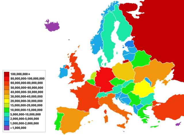
Image:Europe population map countries.png
From Wikipedia, the free encyclopedia

Size of this preview: 640 × 468 pixels
Full resolution (1,153 × 844 pixels, file size: 38 KB, MIME type: image/png)
Summary
Made a newer version of the map
Licensing
 |
I, the copyright holder of this work, hereby release it into the public domain. This applies worldwide. In case this is not legally possible, |
File history
Click on a date/time to view the file as it appeared at that time.
| Date/Time | Dimensions | User | Comment | |
|---|---|---|---|---|
| current | 19:25, 3 February 2008 | 1,153×844 (38 KB) | Jameswberk ( Talk | contribs) | (Added 50-60 Million range for Italy and changed shades accordingly. ) |
| revert | 19:23, 3 February 2008 | 1,153×844 (38 KB) | Jameswberk ( Talk | contribs) | (Last upload incorrect, this one is correct.) |
| revert | 19:19, 3 February 2008 | 1,153×844 (35 KB) | Jameswberk ( Talk | contribs) | (Changed shade for Italy which has substantialy more population than anyone else in the 40-60 million range and added a 50-60 million range ) |
| revert | 20:55, 15 May 2007 | 1,153×844 (45 KB) | Sideshow Bob ( Talk | contribs) | (A minor correction made) |
| revert | 00:24, 10 May 2007 | 1,153×844 (45 KB) | Sideshow Bob ( Talk | contribs) | (Made a newer version of the map) |
See the setup instructions for more information.
File links
The following pages on Schools Wikipedia link to this image (list may be incomplete):
Categories: User-created public domain images