Mekong
2008/9 Schools Wikipedia Selection. Related subjects: Geography of Asia
| This article contains Chinese text. Without proper rendering support, you may see question marks, boxes, or other symbols instead of Chinese characters. |
| Mekong (Mae Nam Khong) | |
|---|---|
| Láncāng Jiāng, Mae Khaung, Mènam Khong, Mékôngk, Tonle Thom, Sông Cửu Long | |
|
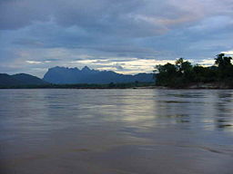
View of the Mekong before sunset.
|
|
| Countries | |
| Length | 4,880 km (3,000 mi) |
| Watershed | 795,000 km² (307,000 sq mi) |
| Discharge at | South China Sea |
| - average | 16,000 m³/ s (570,000 cu ft/ s) |
| - maximum | 39,000 m³/ s (1,380,000 cu ft/ s) |
| Source | Lasagongma Spring |
| - location | Mt. Guozongmucha, Qinghai, China |
| - coordinates | |
| - elevation | 5,224 m (17,139 ft) |
| Mouth | Mekong Delta |
| - elevation | 0 m (0 ft) |
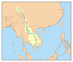
The Mekong is one of the world’s major rivers. It is the 11th-longest river in the world, and 7th longest in Asia. (discharging 475 km³/114 cu mi of water annually). Its estimated length is 4,350 km (2,703 mi), and it drains an area of 795,000 km² (307,000 sq mi). From the Tibetan Plateau it runs through China's Yunnan province, Burma, Thailand, Laos, Cambodia and Vietnam. All except China and Burma belong to the Mekong River Commission. A South Asian regional association, Mekong-Ganga Cooperation is named after this river. The extreme seasonal variations in flow and the presence of rapids and waterfalls have made navigation extremely difficult.
Names
The river was originally named by the local Tai peoples as Mae Nam Khong meaning "Mother-River Khong"; Mae Khong for short, meaning "Mother Khong". This was picked up and phoneticised in Chinese as Méigōng Hé (湄公河) for the external part, without realising this translates as "Mother-Khong River", with Mae-Nam Khong River literally translated as "Mother-River Khong River."
In English it is called "the Mekong River", but in the Tai languages it is essentially the "Khong River." Such is the case with the Mae Nam Ping in Chiang Mai which is known as the "Ping River", and the Tonle Sap in Cambodia - where Tonle translates as "Great lake or river", making the Tonle Sap River an unnecessary repetition of what is in fact the "Sap River."
In Thai, โขง IPA: [kʰǒːŋ] is a species of crocodile; some believe this is tone-shifted from คด IPA: [kʰót] or โค้ง IPA: [kʰóːŋ], both adjectives to describe curves or meanders of a river or road.
- Tibetan: རྫ་ཆུ་ rDza chu (扎曲 Pīnyīn: Zā Qū)
- Chinese: 澜沧江, 瀾滄江 Láncāng Jiāng ("Turbulent River“), 湄公河 Méigōng hé
- Burmese: မဲခောင္မ္ရစ္ Mè‘kaung Myit
- Thai: แม่น้ำโขง IPA: [mɛ̂ː náːm kʰǒːŋ], แม่โขง IPA: [mɛ̂ː kʰǒːŋ]
- Laotian: ແມ່ນ້ຳຂອງ IPA: [mɛː nâːm kʰɔ̌ːŋ], ນ້ຳຂອງ IPA: [nâːm kʰɔ̌ːŋ]
- Khmer: មេគង្គ Mekongk, ទន្លេមេគង្គ Tonle Mekongk, ទន្លេធំ Tonle Thom ("Great River“)
- Vietnamese: Sông Mê Kông, Sông Lớn ("Great River"), Sông Cửu Long ("Nine Dragons River")
Fauna
The biodiversity of the Mekong mountains is one of the richest in the world. More than 1200 species of fish have been identified and there could be possibly as many as 1700. Fishing is a very important part of the economic activities in the area and a vital source of protein in the local diet. Estimates indicate that some 120 fish species are commercially traded but most of the fishery is based on 10-20 species.
In the Upper Mekong, the northern part of the river down to the Burma-Thai-Laos boarder, the river is relatively clear and fast flowing with the influx snowmelt guaranteeing a relatively uniform circumannual flow in the river. The water tends to be neutral, with a pH of 6.9 ranging to 8.2 and the nutrient level is low. In the Lower Mekong area the river is turbid , especially during the rainy season. Due to bank erosion the water gets a rusty-tan colour from the soil. The river temperature in the Lower Mekong varies between 21.1°C to 27.8°C and the pH fluctuates between 6.2 to 6.5. The two main biotopic areas in the river follow the division between the Upper and Lower Mekong. The fish in the fast-flowing upper reaches are dominated by different loaches ( Cobitidae), sucker catfish ( Sisoridae), hillstream loach ( Homalopteridae) and carp ( Garrinae). The slower middle and lower parts of the river are dominated by species of carp ( Cyprinidae), catfish ( Siluridae, Clariidae, Schilbeidae, Bagridae, Sisoridae and Akysidae) and murrels ( Chanidae and Ophicephalidae).
No other river is home to so many species of very large fish. The biggest include the Giant River Carp (Probarbus jullieni), which can grow up to 1.5m and weigh 70kg, the Giant pangasius (Pangasius sanitwongsei), Siamese giant carp (Catlocarpio siamensis) and the endemic Mekong Giant Catfish (Pangasianodon gigas), all three of which can grow up to about 3m in length and weigh 300 kg. All of these are in serious decline, both because of dams and flood control and overfishing.
One species of freshwater dolphin, the Irrawaddy dolphin (Orcaella brevirostris), was once common in the whole of the Lower Mekong but is now very rare.
Among other wetland mammals that have been living in and around the river are the Smooth-coated otter (Lutra perspicillata) and fishing cat (Felis viverrina).
The endangered Siamese crocodile (Crocodylus siamensis) is reported to occur along the Mekong but is very rare.
History
The difficulty of navigating the river has meant that it has divided, rather than united, the people who live near it. The earliest known settlements date to 2100 BCE, with Ban Chiang being an excellent example of that early Iron Age culture. The earliest recorded civilisation was the 1st century Indianised-Khmer culture of Funan, in the Mekong Delta. Excavations at Oc Eo, near modern An Giang, have found coins from as far away as the Roman Empire. This was succeeded by the Khmer culture Chenla state by around the 5th century. The Khmer empire of Angkor was the last great Indianized state in the region. From around the time of the fall of the Khmer empire, the Mekong was the frontline between the emergent states of Siam and Tonkin (North Vietnam), with Laos and Cambodia, then situated on the coast, torn between their influence.
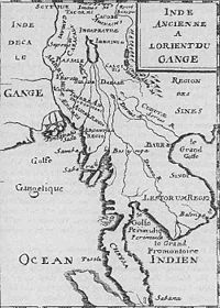
The first European to encounter the Mekong was the Portuguese Antonio de Faria in 1540; a European map of 1563 depicts the river, although even by then little was known of the river upstream of the delta. European interest was sporadic: the Spaniards and Portuguese mounted some missionary and trade expeditions, while the Dutch Gerrit van Wuysthoff led an expedition up the river as far as Vientiane in 1641-42.
The French took a serious interest in the region in the mid-19th century, capturing Saigon, from Vietnamese invaders, in 1861, and establishing a protectorate over Cambodia in 1863.
The first systematic exploration began with the French Mekong Expedition led by Ernest Doudard de Lagrée and Francis Garnier, which ascended the river from its mouth to Yunnan between 1866 to 1868. Their chief finding was that the Mekong had too many falls and rapids to ever be useful for navigation. The river's source was located by Pyotr Kuzmich Kozlov in 1900.
From 1893, the French extended their control of the river into Laos, establishing French Indochina by the first decade of the 20th century. This lasted until the First and Second Indochina Wars ended French and American involvement in the region.
After the Vietnam War, the tensions between the U.S.-backed Thai government and the new Communist governments in the other countries prevented cooperation on use of the river.
Bridges
The Thai–Lao Friendship Bridge ( Thai: สะพาน มิตรภาพ ไทย-ลาว Saphan Mittaphap Thai-Lao) connects Nong Khai city with Vientiane in Laos. The 1170-metre-long bridge has two 3.5 m-wide lanes with an unfinished single railway line in the middle. On March 20, 2004 the Thai and Lao governments agreed to extend the railway to Tha Nalaeng in Laos
The Second Thai–Lao Friendship Bridge connects Mukdahan to Savannakhet. The two-lane, 12-metre-wide, 1600-metre-long bridge opened to the general public on January 9, 2007.
There is also a third bridge, located in Champasak province, in Laos. Unlike the Friendship bridges, this bridge is not a border crossing. It is 1,380 metres (4,528 ft) long, and was completed in 2000 ( Pakxe bridge ).
Cambodia has one two-lane bridge located near the city of Kompong Cham, on the road linking Phnom Penh with the remote provinces of Ratanakiri and Mondolkiri, and further away Laos.
Dams
China Western Development
| Mekong Dams | compl. | MW | Geo coordinate |
|---|---|---|---|
| Gongguoqiao Dam | 2008 | 750 |
|
| Xiaowan Dam | 2013 | 4200 |
|
| Manwan Dam | 1996 | 1500 |
|
| Dachaoshan Dam | 2003 | 1350 |
|
| Nuozhadu Dam | 2017 | 5850 | |
| Jinghong Dam | 2010 | 1750 |
|
| Ganlanba Dam | n/a | 150 | |
| Mengsong Dam | n/a | 600 |
Environmental concerns
The two most controversial current issues are the building of dams and the blasting of rapids.
A number of dams have already been built on the river's tributaries, notably the Pak Mun dam in Thailand. This has been criticized on grounds of cost as well as damage to the environment and to the livelihoods of affected villagers, though none have been built on the main part itself.
China is engaged in an extensive program of dam-building on the river itself: it has already completed one at Manwan, a second is under construction at Dachaoshan, and another twelve are under consideration.
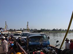
Poverty stricken Cambodia is one nation that is completely dependent on the river for food and the vast majority of its fledgling economy. The annual floods provide much needed water for crops of the otherwise dry dusty land, and to refresh Tonle Sap, yet its major cities are all vulnerable to flooding. The Mekong River Commission, a panel of the region's nations, has accused China of blatant disregard for the nations downstream in its plans to dam the river in an effort to stop the dams, but to no avail. Since the building of the first Chinese dam, many species have become endangered including the Mekong dolphin and manatee, water levels have dropped as ferries get stuck, fish caught are small and the catch is less than half of before the dam, the turnover at Chiang Rai port is less than 1/4 of previous years, and crossings from Chiang Rai to isolated Luang Prabang have lengthened from 8 hours to 2 days due to inadequate water levels.
Despite all these problems, new dams planned will have significantly worse impact if carried out as planned. All nations downstream and the environment will suffer from added pollution (due to development and relatively lax regulation and enforcement in China compared to Thailand, poisoning the food supply from pesticide runoff and heavy industry, as well as promoting algal blooms from organophosphates from agriculture, as well as water hyacinth infestation), river blockage problems as fish cannot swim upstream to spawn, and potentially devastating very low water flow.
Other environmental concerns arise from increased water flow in some parts as well as China clears rocks and sandbars, blasts gorges, and slows water as it dams and floods other sections, and relocates indigenous peoples. Cambodia by far the most exposed, depending on a fine balance of water flow, fearing scenarios of mass famine and devastating floods, the likes of which destroyed the Angkor kingdom 700 years ago. Laos' biggest cities all hug the Mekong as does Vietnam's largest city and financial hub, Ho Chi Minh City, which would be vulnerable mostly to low flow and pollution.
Trivia
- Balls of light are observable from time to time rising from the water's surface in the stretch of the river near Vientiane or Nong Khai. These are sometimes referred to as Naga fireballs. The locals attribute the phenomenon to Phaya Naga, Mekong Dragons.
- According to researchers the river houses more species of giant fish than any world river , most notably the Giant Mekong Catfish.
- The low tide level of the river in Cambodia is lower than the high tide level out at sea, and the flow of the Mekong inverts with the tides throughout its stretch in Vietnam and up to Phnom Penh. The very flat Mekong Delta area in Vietnam is thus prone to flooding, especially in the provinces of An Giang and Dong Thap (Đồng Tháp), near the Cambodian border.


