Image:Durham 1610.jpg
From Wikipedia, the free encyclopedia
No higher resolution available.
Durham_1610.jpg (400 × 419 pixels, file size: 31 KB, MIME type: image/jpeg)
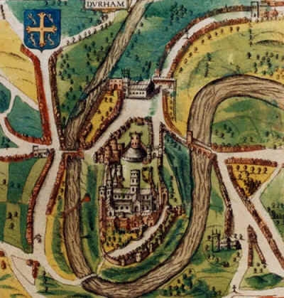
A map of Durham, England from 1610, by the famous cartographer John Speed. The cathedral and castle are shown, as is the River Wear which surrounds the city on three sides. a big yellow spot on the cathedral
| |
This file has been released into the public domain by the copyright holder, its copyright has expired, or it is ineligible for copyright. This applies worldwide. | ||
|
|||
File history
Click on a date/time to view the file as it appeared at that time.
| Date/Time | Dimensions | User | Comment | |
|---|---|---|---|---|
| current | 16:24, 22 August 2004 | 400×419 (31 KB) | Trilobite ( Talk | contribs) | (Map of Durham by John Speed, 1610, public domain) |
See the setup instructions for more information.
File links
The following pages on Schools Wikipedia link to this image (list may be incomplete):
Categories: Public domain images | PD tag needs updating