Image:Yangtze River Map.png
From Wikipedia, the free encyclopedia
No higher resolution available.
Yangtze_River_Map.png (576 × 355 pixels, file size: 123 KB, MIME type: image/png)
Summary
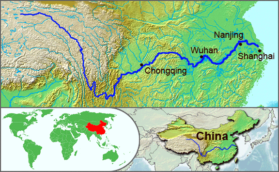
The underlying topographic maps used in this image come from the Demis Web Map Server, and are in the public domain. The world locator map is derived from Image:BlankMap-World.png. I added the feature layers myself. — Papayoung ☯ 20:57, 1 October 2005 (UTC)
Licensing
| |
Permission is granted to copy, distribute and/or modify this document under the terms of the GNU Free Documentation License, Version 1.2 or any later version published by the Free Software Foundation; with no Invariant Sections, no Front-Cover Texts, and no Back-Cover Texts. Subject to disclaimers. |
File history
Click on a date/time to view the file as it appeared at that time.
| Date/Time | Dimensions | User | Comment | |
|---|---|---|---|---|
| current | 20:51, 1 October 2005 | 576×355 (123 KB) | Papayoung ( Talk | contribs) | (The underlying topographic maps used in this image come from the [http://www2.demis.nl/mapserver/mapper.asp Demis Web Map Server], and are in the public domain. The world locator map is derived from BlankMap-World.png.) |
| revert | 22:57, 25 September 2005 | 936×363 (216 KB) | Papayoung ( Talk | contribs) | (The underlying topographic maps used in this image come from the [http://www2.demis.nl/mapserver/mapper.asp Demis Web Map Server], and are in the public domain. I added the feature layers myself. —~~~~) |
See the setup instructions for more information.
File links
The following pages on Schools Wikipedia link to this image (list may be incomplete):