From Wikipedia, the free encyclopedia
 Size of this preview: 593 × 479 pixels
 Full resolution (2,305 × 1,863 pixels, file size: 641 KB, MIME type: image/jpeg)
 |
This is a file from the Wikimedia Commons. The description on its description page there is shown below.Commons is a freely licensed media file repository. You can help.
|
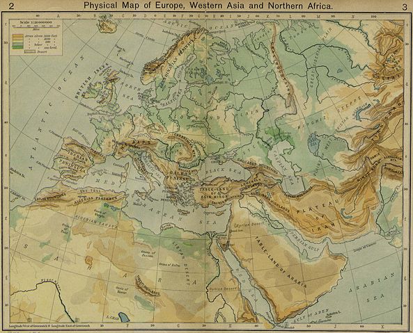
{[ew|en|Wirya}} A historical Physical Map of Europe, Western Asia and Northern Africa by William R. Shepherd, New York, Henry Holt and Company, 1926. Map from: , in Public Domain
 |
This file has been released into the public domain by the copyright holder, its copyright has expired, or it is ineligible for copyright. This applies worldwide. |
 |
Note: This tag is obsolete! Nothing is public domain without a reason. Don't use this generic template - please use instead:
- {{ PD-old}} (for works out of copyright where the author has been dead for over 70 years),
- {{ PD-Art}} (for photos of old paintings and art out of copyright),
- {{ PD-ineligible}} (for trivial work),
- {{ PD-USGov}} (for work by the U.S. federal government),
- {{ PD-self}} (if the uploader and creator releases the rights),
- {{ PD-user|user}} (if another user released his/her rights), or {{ Copyrighted free use}}.
- use {{ PD-user-w| projectcode|projectname|username}} for users with no account on Commons.
- {{ PD-author|Author's name}} - for works released into the public domain by non-Wikimedia users.
- If the work is PD for another reason, check the copyright tag page or use {{ PD-because|reason}}.
العربية | Български | Česky | Deutsch | English | Español | Français | हिन्दी | Italiano | 日本語 | Norsk (bokmål) | Norsk (nynorsk) | Polski | Português | Русский | Slovenčina | Slovenščina | Српски / Srpski | Türkçe | 中文 | +/-
|
File history
Click on a date/time to view the file as it appeared at that time.
|
|
Date/Time |
Dimensions |
User |
Comment |
| current |
14:53, 3 December 2006 |
2,305×1,863 (641 KB) |
Electionworld |
|
File links
The following pages on Schools Wikipedia link to this image (list may be incomplete):
