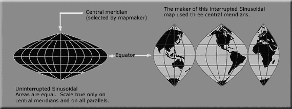
Image:Usgs map sinousidal equal area.PNG
From Wikipedia, the free encyclopedia

No higher resolution available.
Usgs_map_sinousidal_equal_area.PNG (570 × 213 pixels, file size: 13 KB, MIME type: image/png)
File history
Click on a date/time to view the file as it appeared at that time.
| Date/Time | Dimensions | User | Comment | |
|---|---|---|---|---|
| current | 07:39, 16 October 2006 | 570×213 (13 KB) | Matt314 | (higher resolution (same source)) |
| 14:27, 17 February 2005 | 427×167 (36 KB) | Quadell | (World map projection ([http://erg.usgs.gov/isb/pubs/MapProjections/projections.html source)]{{PD-USGov-USGS}} Category:World maps Category:Map projections Category:Map diagrams) |
File links
The following pages on Schools Wikipedia link to this image (list may be incomplete):
Categories: Images of map projections

